


Pointe de Terre Rouge par le passage du Pic du Thabor et le col des Marches
The proposed circuit varies the atmospheres passing from the verdant valley of Neuvache to the harsh minerality of the valleys dominated by the Pic du Thabor and the Cheval Blanc, before climbing the wild slopes of the Col des Marches. A wonder !
From the Chenalette car park, take the GR de Pays du Tour du Mont Thabor, following the signs indicating the Notre Dame des Neiges chapel, which can be reached in about an hour and a half.
Continue on this path, which gently goes up the wide Neuvache valley, to the rock called “Pierre du Déjeuner”, an ideal place, in fact, to have a quick snack before getting down to business.
You have to leave the GR de pays about 400 meters after the Pierre du Déjeuner, at the level of an easily identifiable grassy hilltop, on the left. Beginning of the off-trail.
Rise on this grassy hilltop, then in the stony ground (very stable and not too steep) which succeeds it, by first orienting yourself East-North-East until the rocky prominence listed 2872, which one circumvents, then full North. You can aim for what, from below, looks like a cairn marking the Passage du Pic du Thabor (2952 meters). In fact, it's not a cairn, just a rock… But when you reach it, you have actually reached this pass.
From the Passage du Pic du Thabor, head north-east to best climb the Pointe de Terre Rouge, bypassing the rocky escarpments. Still no path (at least, I didn't see any), but we don't really need it.
From the summit, there is a very nice view of, in particular, the west face of the Pic du Thabor and the Vanoise massif… Well, when the weather is right… Which was not the case for me, alas.
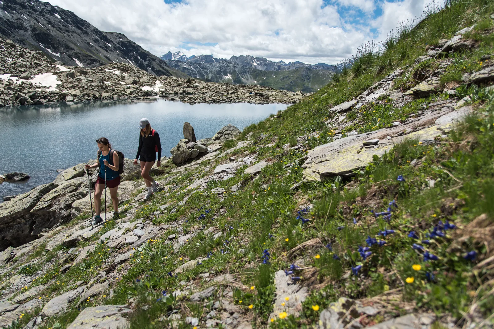
Descend towards the pretty lakes located just below the Passage du Pic du Thabor. From the most northerly of them, it's simple: just follow the small stream that escapes from it, until you reach a larger torrent, oriented South-North, which you also have to follow, in less steep slopes.
At the level of a beautiful flat area where we find the greenery, this torrent, joined by the one that descends from Lac Pépin, turns towards the East. From there, you can see the path slightly below that leads to the refuge of the Marches (this is, again, the GR de pays du Tour du Mont Thabor).
Gain, just in front of the refuge, the footbridge which marks the beginning of the climb to the Col des Marches... Climb sometimes a little steep, but magnificent, especially when you dominate the unnamed lake listed 2508 (Lac du Jeu?) .
Past the pass, from where you can see the Lac de Roche Noire, you have to descend about 200 meters and leave the GR de pays again to reach this lake, by a well-marked path which then crosses the ridge. du Petit Fourchon then descends to the sheepfolds of Le Vallon and La Losa.
At La Losa, the loop is complete: we find the path from the start. Turn right towards the Chenalette.
Continue on this path, which gently goes up the wide Neuvache valley, to the rock called “Pierre du Déjeuner”, an ideal place, in fact, to have a quick snack before getting down to business.
You have to leave the GR de pays about 400 meters after the Pierre du Déjeuner, at the level of an easily identifiable grassy hilltop, on the left. Beginning of the off-trail.
Rise on this grassy hilltop, then in the stony ground (very stable and not too steep) which succeeds it, by first orienting yourself East-North-East until the rocky prominence listed 2872, which one circumvents, then full North. You can aim for what, from below, looks like a cairn marking the Passage du Pic du Thabor (2952 meters). In fact, it's not a cairn, just a rock… But when you reach it, you have actually reached this pass.
From the Passage du Pic du Thabor, head north-east to best climb the Pointe de Terre Rouge, bypassing the rocky escarpments. Still no path (at least, I didn't see any), but we don't really need it.
From the summit, there is a very nice view of, in particular, the west face of the Pic du Thabor and the Vanoise massif… Well, when the weather is right… Which was not the case for me, alas.
Descend towards the pretty lakes located just below the Passage du Pic du Thabor. From the most northerly of them, it's simple: just follow the small stream that escapes from it, until you reach a larger torrent, oriented South-North, which you also have to follow, in less steep slopes.
At the level of a beautiful flat area where we find the greenery, this torrent, joined by the one that descends from Lac Pépin, turns towards the East. From there, you can see the path slightly below that leads to the refuge of the Marches (this is, again, the GR de pays du Tour du Mont Thabor).
Gain, just in front of the refuge, the footbridge which marks the beginning of the climb to the Col des Marches... Climb sometimes a little steep, but magnificent, especially when you dominate the unnamed lake listed 2508 (Lac du Jeu?) .
Past the pass, from where you can see the Lac de Roche Noire, you have to descend about 200 meters and leave the GR de pays again to reach this lake, by a well-marked path which then crosses the ridge. du Petit Fourchon then descends to the sheepfolds of Le Vallon and La Losa.
At La Losa, the loop is complete: we find the path from the start. Turn right towards the Chenalette.
Further information) :
Itinerary partly off-trail and unmarked, therefore requiring a minimum sense of direction;
Quite a long hike with a significant elevation gain (approximately 1900 meters), but it is possible to do it in a day and a half by spending a night at the Marches refuge (in this case: 1350 meters of elevation gain on the first day, 550 meters on the second).
Quite a long hike with a significant elevation gain (approximately 1900 meters), but it is possible to do it in a day and a half by spending a night at the Marches refuge (in this case: 1350 meters of elevation gain on the first day, 550 meters on the second).
Location details
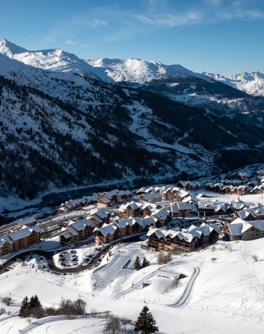
From Saint-Michel-de-Maurienne, take the D 215a until its end, at Valmeinier 1800. After the large arc-shaped parking lot, turn right then, immediately, right again, the track which leads directs (indicated by a sign) towards the Chenalette car park, starting point of the hike.
- In the mountains
Opening
| Opening hours from May 15 to October 15, 2024 | |
|---|---|
| Monday | Open |
| Tuesday | Open |
| Wednesday | Open |
| Thursday | Open |
| Friday | Open |
| Saturday | Open |
| Sunday | Open |
Further information) :
Subject to favorable weather conditions
Prices
Services
Activities on site
- Pedestrian sports
- Hiking route