


Tour du Lac de Bissorte et Lac des Bataillères par le Prec
This loop allows you to discover the large Bissorte dam and its environment. You can also extend the itinerary with a round trip to Lac des Batailleres.
ALL
Take the path which starts 50 meters before the car park and which rises rapidly on the small Prec plateau.
Shortly after, follow the path on the left which descends towards the Ruisseau de Bissorte, crosses it on a footbridge and climbs to the eastern end of the dam.
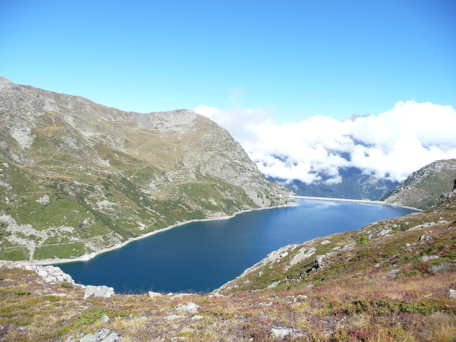
Cross the dam and go up on the left bank of Lac de Bissorte.
At the end of the lake, the path climbs to reach a footbridge under the Refuge des Marches.
BATAILLERES LAKE
About 150 meters above the refuge, at the intersection, continuing straight ahead, you can climb up to Lac des Batailleres (2422m). A sign estimates the ascent time at 50 minutes.
Return to the intersection above the refuge.
RETURN
For the return to the right bank of the dam lake, the path goes up to the right above the refuge and runs along the entire east bank of the Bissorte lake.
It eventually descends to the eastern end of the dam. Cross this one again.
At its western end, go down to the right on the path. Do not continue towards the house but follow the path to the left.
By a path remarkably laid out in the cliff, you can go down to the Prec.
Take the path which starts 50 meters before the car park and which rises rapidly on the small Prec plateau.
Shortly after, follow the path on the left which descends towards the Ruisseau de Bissorte, crosses it on a footbridge and climbs to the eastern end of the dam.
Cross the dam and go up on the left bank of Lac de Bissorte.
At the end of the lake, the path climbs to reach a footbridge under the Refuge des Marches.
BATAILLERES LAKE
About 150 meters above the refuge, at the intersection, continuing straight ahead, you can climb up to Lac des Batailleres (2422m). A sign estimates the ascent time at 50 minutes.
Return to the intersection above the refuge.
RETURN
For the return to the right bank of the dam lake, the path goes up to the right above the refuge and runs along the entire east bank of the Bissorte lake.
It eventually descends to the eastern end of the dam. Cross this one again.
At its western end, go down to the right on the path. Do not continue towards the house but follow the path to the left.
By a path remarkably laid out in the cliff, you can go down to the Prec.
Further information) :
670m altitude difference (870m with Lac des Batailleres)
Location details
- In the mountains
Opening
| Opening hours from May 15 to October 15, 2024 | |
|---|---|
| Monday | Open |
| Tuesday | Open |
| Wednesday | Open |
| Thursday | Open |
| Friday | Open |
| Saturday | Open |
| Sunday | Open |
Further information) :
Subject to favorable weather conditions
Prices
Services
Activities on site
- Pedestrian sports
- Hiking route